Drone-based Topographic Survey for Ashulia Model Town
- June 30, 2025
- Posted by: GeoTech Engineering Ltd
- Categories:
Drone-based topographic survey
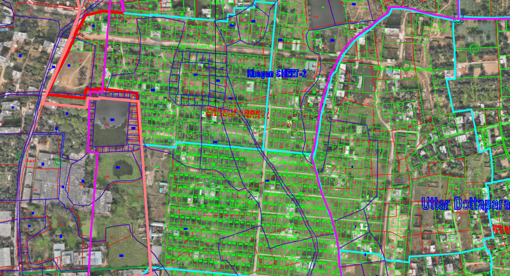
Project Summary
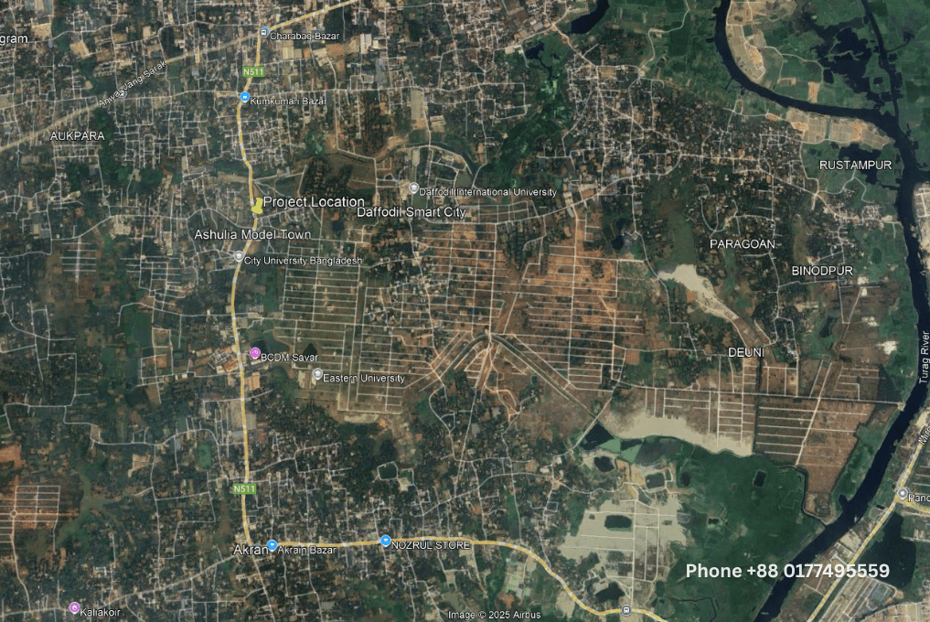
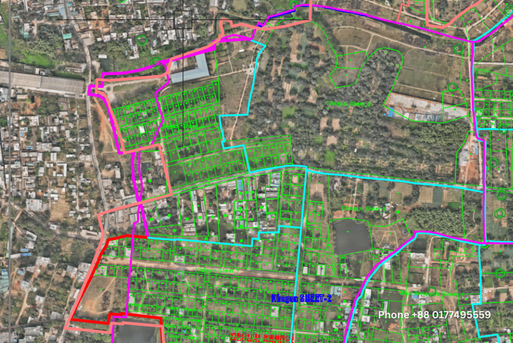
- Project Name: Ashulia Model Town
- Location: Biralia, Savar Upazila, Dhaka Division
- Client: Amin Mohammad Lands Development Ltd.
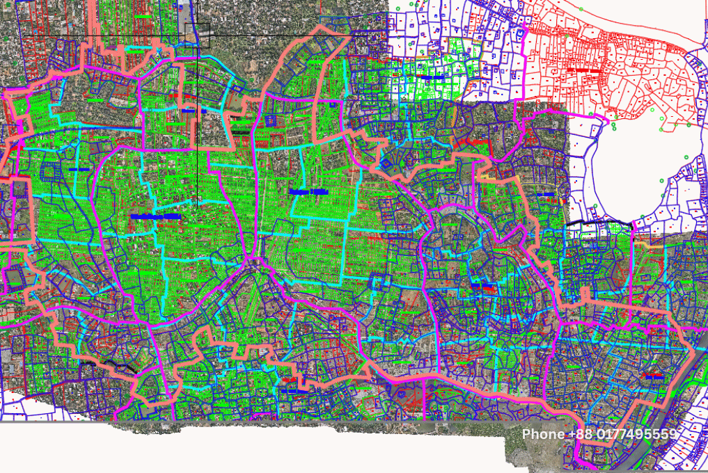
- Project Area: 10.00 SQKM
- Project Title: Drone-Based Topography Survey, C.S, R.S, and City Mouza Map Adjustment
This 10-square-kilometer project was aimed at developing a planned township in one of the fastest-growing zones near Dhaka. To support the client’s long-term development strategy, our team delivered a complete GIS-ready topographic mapping solution powered by drone data and ground verification.
Scope of Work
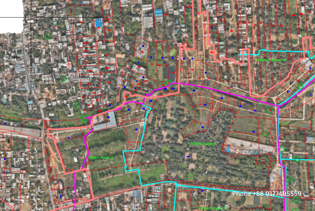
1. TBM Installation & Static GPS Observations
We established permanent Temporary Bench Marks (TBMs) using high-precision static GPS methods, forming the base reference for all subsequent geospatial activities.
2. High-Resolution Drone Survey
Using DJI Mavic 3 Enterprise drones, our aerial team captured high-resolution imagery, ensuring centimeter-level positional accuracy, essential for engineering and planning.
3. Mouza Map Location Verification
We conducted on-site field verification to accurately geolocate C.S, R.S, and City Survey Mouza boundaries, ensuring alignment with current ground realities.
4. Ortho-Mosaic Creation & Digitization
Drone images were processed using DJI Terra to generate seamless, high-definition ortho-mosaics. These were then digitized for accurate base mapping.
5. Map Digitization (C.S, R.S, City)
Our GIS experts scanned and digitized all legacy Mouza maps, aligning them with the national coordinate system through precise rectification techniques.
6. Joint Line Adjustment
To eliminate overlaps and inconsistencies, we refined and corrected Mouza map joint lines through ground surveys and geospatial editing.
7. Pentagraph Mapping
We developed a combined map overlay (pentagraph) that integrates all survey types—C.S, R.S, and City—with real-time field data, creating a unified cadastral model.
8. Final GIS & CAD Deliverables
All outputs were delivered in standard formats including Shapefiles (.shp) for GIS use and AutoCAD (.dwg/.dxf) for design and documentation.
Tools & Technology Used
Hardware
- DJI Mavic 3 Enterprise – For aerial imagery and topographic modeling
- CSC iBase – Base station for static GPS observations
- CSC i89 GPS – Rover station for ground control points
Software
- DJI Terra – Image stitching and orthophoto creation
- ArcGIS – Spatial analysis and map digitization
- AutoCAD – Precision drafting and layout production
Key Benefits of Drone-Based Topographic Surveys
Drone surveys are redefining land mapping and urban planning across Bangladesh. Here’s why:
✅ Accuracy & Detail
With sub-centimeter precision, drone imagery provides more accurate data than many traditional methods.
✅ Faster Turnaround
What may take weeks via ground survey can often be completed in a matter of days using UAV systems.
✅ Cost-Efficiency
Reduced manpower, equipment logistics, and time translate to significantly lower costs.
✅ Safer Operations
Drones can safely access challenging or hazardous terrains, reducing human exposure to risk.
✅ Seamless Integration
Outputs from drone surveys are easily compatible with CAD, GIS, and BIM systems, streamlining your planning pipeline.
✅ Environmental Friendly
Minimal ground disturbance compared to conventional methods—perfect for sensitive or protected areas.
Project Impact
The Ashulia Model Town survey played a crucial role in guiding Amin Mohammad Lands Development Ltd. toward informed decision-making. Our mapping products enabled:
- Accurate land acquisition planning
- Effective urban zoning and utility alignment
- Smoother integration with government land records
- Reduced survey disputes and development delays
By combining modern drone technology with in-depth local expertise, Geotech Engineering Ltd. has proven how aerial surveys can enhance every stage of land development.
Why Choose Geotech Engineering Ltd.?
We are a trusted name in drone-based surveying, GIS services, and topographic mapping in Bangladesh. With an experienced team, certified drone pilots, and top-tier software solutions, we bring efficiency, clarity, and precision to your project—whether it’s real estate, infrastructure, or environmental analysis.
Let’s Elevate Your Project — One Flight at a Time
Looking for accurate, fast, and affordable mapping solutions? Partner with Geotech Engineering Ltd., and let’s make your vision a reality.
📍 Contact Us Today
Geotech Engineering Ltd.
House # G/53, Road # 1, Block # G, Banasree, Rampura, Dhaka 1219, Bangladesh
📞 +88 0177 4955599 | +880-9638131313
📧 info@geotechengbd.com
🌐 www.geotechengbd.com
Precision. Performance. Progress.
Trust the experts at Geotech Engineering Ltd. for your next land survey or development project.

Top Benefits of Drone-Based Topographic Survey
Powered by Geotech Engineering Ltd.
At Geotech Engineering Ltd., we bring precision and innovation to land and infrastructure development projects through advanced drone-based topographic survey solutions. With the integration of UAV (Unmanned Aerial Vehicle) technology and GIS/CAD processing, we provide fast, accurate, and cost-effective data that helps drive smarter decisions.
Here’s why drone-based surveys are becoming the go-to choice for modern developers, engineers, and planners:
1. Unmatched Accuracy
Using RTK/PPK-enabled drones, we capture precise topographic data to generate highly detailed 3D terrain models, contour maps, and orthophotos with centimeter-level accuracy—crucial for engineering-grade planning and design.
2. Rapid Data Collection
Drone surveys cover large project areas in a fraction of the time compared to traditional methods. Projects that once required weeks in the field can now be completed in just a day or two, dramatically speeding up project timelines.
3. Cost Savings
Reduce the need for large field crews and expensive, time-consuming ground surveys. Drone mapping minimizes manpower and equipment costs while delivering equally (or more) reliable data outputs.
4. Access Difficult & Hazardous Terrain
From water bodies and steep slopes to restricted or dangerous sites, drones can safely capture data where human access is limited or risky—ensuring complete coverage without compromising safety.
5. Visual & Analytical Data in One
Along with geospatial accuracy, drone surveys provide visual documentation through high-resolution aerial imagery and videos. These visuals support ongoing site monitoring, stakeholder reporting, and informed project decision-making.
6. Seamless Integration with GIS & CAD
Survey outputs are processed into ready-to-use formats such as Shapefiles (SHP) and DWG/DXF, fully compatible with platforms like ArcGIS, AutoCAD, Civil 3D, and more—helping your design and planning teams work faster and smarter.
7. Boosted Planning Efficiency
Accurate site data leads to better decisions. Drone surveys eliminate guesswork, allowing project teams to design infrastructure and layouts with greater precision, fewer errors, and reduced rework.
8. Eco-Friendly and Low-Impact
Drone surveys have a minimal footprint. With fewer site visits, less fuel use, and non-invasive data collection, they’re a sustainable solution for environmentally sensitive projects.